This page has every Geography Grade 12 Term 2 paper we have, from 2018 to 2026: 34 question papers and 25 memos in 105 PDFs. The papers were set by Eastern Cape, KwaZulu-Natal, Free State, Gauteng, Limpopo, Mpumalanga and the national DBE. Files are in English and Afrikaans. The newest year is first. Each paper shows the first page of questions, its marks and time, and what the questions cover. Below the papers there are 8 files of Term 2 study material.
Geography Grade 12 Term 2 papers by year
| Year | Exams | Papers | PDFs |
|---|---|---|---|
| 2026 | June, May/June | 10 | 20 |
| 2025 | June, May/June | 5 | 11 |
| 2024 | May/June | 2 | 6 |
| 2023 | May/June | 2 | 10 |
| 2022 | June, May/June | 5 | 12 |
| 2021 | June, May/June | 4 | 18 |
| 2020 | June | 2 | 2 |
| 2019 | May/June | 2 | 8 |
| 2018 | May/June | 2 | 10 |
Topics that come up most in Geography Grade 12 Term 2
Counted from the questions in the papers on this page: how many papers each topic appears in, and its average marks.
| Topic | Papers | Average marks |
|---|---|---|
| Application and Interpretation | 4 | 25 |
| Multiple-Choice Questions | 4 | 15 |
| Geographical Information Systems (Gis) | 4 | 15 |
| Map Calculations and Techniques | 3 | 20 |
| Economic Geography of South Africa | 1 | 60 |
| Geographical Skills and Techniques | 1 | 30 |
| Mapwork Techniques and Calculations | 1 | 20 |
Geography Grade 12 Term 2 2026 question papers and memos
June 2026 (Eastern Cape)
150 marks · 3 hours · 21 pages · 4 questions
What is in this paper (4 questions)
- Q1 Climate and Weather
- Q2 Geomorphology
- Q3 Rural and Urban Settlements
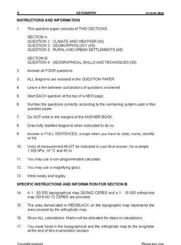
- Q4 Geographical Skills and Techniques2. Answer all FOUR questions. 30 marks
Instructions to candidates
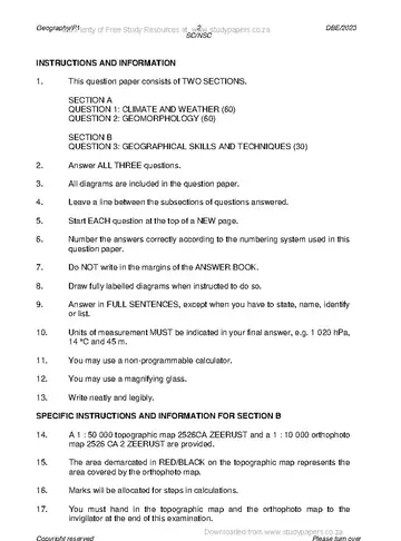
- This question paper consists of TWO SECTIONS.
June 2026 (KwaZulu-Natal)
June 2026 Paper 1 (Free State)
June 2026 Paper 1 (Gauteng)
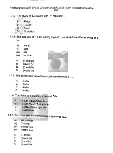
June 2026 Paper 1 (Limpopo)
June 2026 Paper 1 (Mpumalanga)
June 2026 Paper 2 (Gauteng)
26 pages · 3 questions
What is in this paper (3 questions)
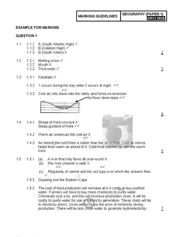
- Q1 1.1 1.1.1 A (South Atlantic High) 60 marks
- Q2 Urban Settlements2.1 Various options are provided as possible answers to the following questions. 60 marks
- Q3 Geographical Skills and TechniquesCoordinates: 33°01′03″S; 27°54′17″E 30 marks
May/June 2026 Paper 1 (National DBE)
150 marks · 3 hours · 3 questions
The memo for this paper is not available yet.
What is in this paper (3 questions)
- Q1 Climate and Weather
- Q2 Geomorphology
- Q3 Geographical Skills and Techniques2. Answer ALL THREE questions. 60 marks
Instructions to candidates
- This question paper consists of TWO sections.
May/June 2026 Paper 2 (National DBE)
Geography Grade 12 Term 2 2025 question papers and memos
June 2025 Paper 1
150 marks · 3 hours · 19 pages · 4 questions
The memo for this paper is not available yet.
What is in this paper (4 questions)
- Q1 Climate and Weather
- Q2 Geomorphology
- Q3 Settlements
- Q4 Geographical Skills and Techniques2. Answer all FOUR questions. 30 marks
Instructions to candidates
- This question paper consists of TWO SECTIONS.
June 2025 Paper 1 (Free State)
June 2025 Paper 2 (Free State)
May/June 2025 Paper 1 (National DBE)
150 marks · 3 hours · 18 pages · 3 questions
Some files on this card: WCED ePortal, shared unchanged under CC BY-NC-ND.
What is in this paper (3 questions)
- Q1 Climate and Weather
- Q2 Geomorphology
- Q3 Geographical Skills and Techniques2. Answer ALL THREE questions. 60 marks
Instructions to candidates
- This question paper consists of TWO sections.
May/June 2025 Paper 2 (National DBE)
150 marks · 3 hours · 19 pages · 3 questions
Some files on this card: WCED ePortal, shared unchanged under CC BY-NC-ND.
What is in this paper (3 questions)
- Q1 Rural and Urban Settlements
- Q2 Economic Geography of South Africa
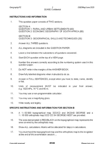
- Q3 Geographical Skills and Techniques2. Answer ALL THREE questions. 60 marks
Instructions to candidates
- This question paper consists of TWO sections.
Geography Grade 12 Term 2 2024 question papers and memos
May/June 2024 Paper 1
150 marks · 3 hours · 19 pages · 3 questions
What is in this paper (3 questions)
- Q1 Climate and Weather
- Q2 Geomorphology
- Q3 Geographical Skills and Techniques2. Answer ALL THREE questions. 60 marks
Instructions to candidates
- This question paper consists of TWO sections.
May/June 2024 Paper 2
150 marks · 3 hours · 19 pages · 3 questions
The memo for this paper is not available yet.
What is in this paper (3 questions)
- Q1 Rural and Urban Settlements
- Q2 Economic Geography of South Africa
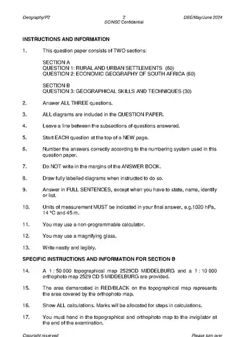
- Q3 Geographical Skills and Techniques2. Answer ALL THREE questions. 60 marks
Instructions to candidates
- This question paper consists of TWO sections:
Geography Grade 12 Term 2 2023 question papers and memos
May/June 2023 Paper 1
150 marks · 3 hours · 20 pages · 3 questions
What is in this paper (3 questions)
- Q1 Climate and Weather
- Q2 Geomorphology
- Q3 Geographical Skills and Techniques2. Answer ALL THREE questions. 60 marks
Instructions to candidates
- This question paper consists of TWO SECTIONS.
May/June 2023 Paper 2
150 marks · 3 hours · 19 pages · 3 questions
What is in this paper (3 questions)
- Q1 Rural and Urban Settlements
- Q2 Economic Geography of South Africa
- Q3 Geographical Skills and Techniques2. Answer ALL THREE questions. 60 marks
Instructions to candidates
- This question paper consists of TWO sections.
Geography Grade 12 Term 2 2022 question papers and memos
June 2022
150 marks · 3 hours · 20 pages · 4 questions
The memo for this paper is not available yet.
What is in this paper (4 questions)
- Q1 Climate and Weather
- Q2 Geomorphology
- Q3 Settlement
- Q4 Geographical Skills and Techniques2. Answer all FOUR questions. 30 marks
Instructions to candidates
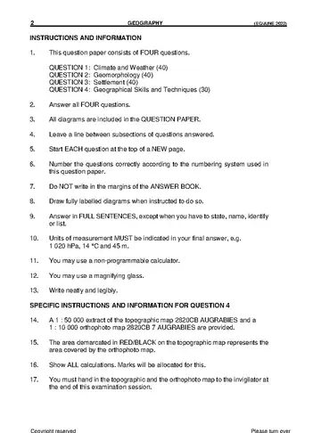
- This question paper consists of FOUR questions.
June 2022 Paper 1 (National DBE)
June 2022 Paper 2 (National DBE)
May/June 2022 Paper 1
May/June 2022 Paper 2
150 marks · 3 hours · 17 pages · 3 questions
What is in this paper (3 questions)
- Q1 Question 1 60 marks
- Q2 Economic Geography of South Africa 60 marks
- Q3 Geographical Skills and Techniques 30 marks
Instructions to candidates
- This question paper consists of TWO SECTIONS:
Geography Grade 12 Term 2 2021 question papers and memos
June 2021 Paper 1 (National DBE)
150 marks · 3 hours · 7 pages · 4 questions
- Question Paper (English)
- Question Paper (English), version 2
- Question Paper
- Question Paper (Afrikaans)
- Question Paper (Afrikaans), version 2
- Memo (English)
- Memo (Afrikaans)
What is in this paper (4 questions)
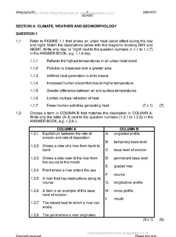
- Q1 Weather and Climatology1.1 FIGURE 1.1 illustrate the development and weather characteristics of a tropical 40 marks
- Q2 Geomorphology2.1 FIGURE 2.1 shows a drainage basin. Choose the correct concept/term/ 40 marks
- Q3 Rural and Urban Settlements3.1 Choose a term in COLUMN B that matches the description in COLUMN A. Write 40 marks
- Q4 Calculations and Map Skills4.1 Refer to blocks D4 and D5 on the topographical map. 30 marks
Instructions to candidates
- This question paper consists of FOUR questions.
- All questions are COMPULSORY.
- All diagrams and maps are included in the ANNEXURE.
- Number the questions correctly according to the numbering system used in this question paper.
- Leave a line between subsections of questions answered.
- Start EACH question on a NEW page.
- Do NOT write in the margins of the ANSWER BOOK.
- Illustrate your answers with labelled diagrams, where possible.
- Mark allocation is as follows: (2 x 1) = (2) means that TWO facts are required for ONE mark each (2 x 2) = (4) means that TWO facts are required for TWO marks each
- If words/action verbs like Name, Identify, Provide, Classify, are used in a question, ONE-word answers are acceptable. If words/action verbs like Discuss, Define, Explain, Comment, Evaluate, Justify, Suggest and Substantiate are used in a question, FULL senten
- In SECTION B you are provided with a 1: 50 000 topographical map (3419 AB CALEDON) and an orthophoto map (3419AB 24 CALEDON) of a part of the mapped area.
- Show ALL calculations. Marks will be allocated for these.
- Indicate the unit of measurement in the final answer of calculations, for example 10 km, 4°C.
- You may use a non-programmable calculator and a magnifying glass.
June 2021 Paper 2 (National DBE)
May/June 2021 Paper 1
225 marks · 3 hours · 15 pages · 4 questions
- Question Paper (English)
- Question Paper (Afrikaans)
- Memo (English)
- Memo (Afrikaans)
- Addendum (English)
- Addendum (Afrikaans)
What is in this paper (4 questions)
- Q1 Question 1 75 marks
- Q2 Question 2 75 marks
- Q3 Question 3
- Q4 Question 4 75 marks
Instructions to candidates
- This question paper consists of FOUR questions.
- Answer ANY THREE questions of 75 marks each.
- All diagrams are included in the ANNEXURE.
- Leave a line between the subsections of questions answered.
- Start EACH question at the top of a NEW page.
- Number the answers correctly according to the numbering system used in this question paper.
- Do NOT write in the margins of the ANSWER BOOK.
- Draw fully labelled diagrams when instructed to do so.
- Answer in FULL SENTENCES, except when you have to state, name, identify or list.
- The unit of measurement and direction must be included in the final answer, where applicable, e.g. 12 km, 10 metres, 14 °C.
- Write neatly and legibly. Geography/P1 3 DBE/2021 SC/NSC
May/June 2021 Paper 2
75 marks · 1 h 30 min · 16 pages · 4 questions
What is in this paper (4 questions)
- Q1 Multiple-Choice QuestionsThe questions below are based on the 1 : 50 000 topographic map 3419AC 15 marks
- Q2 Map Calculations and Techniques2.1 Refer to the topographic map. 20 marks
- Q3 Application and Interpretation3.1 Refer to the topographic map. 25 marks
- Q4 Geographical Information Systems (Gis)4.1 The following information on the Klei Dam at Q (block G8) on the topographic 15 marks
Instructions to candidates
- Write your EXAMINATION NUMBER and CENTRE NUMBER in the spaces on the cover page.
- Answer ALL the questions in the spaces provided in this question paper.
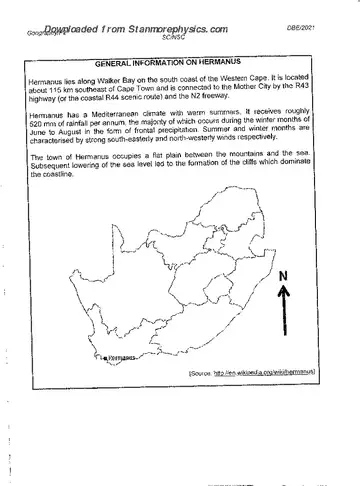
- You are provided with a 1 : 50 000 topographic map (3419AC HERMANUS) and an orthophoto map (3419 AC 20 HERMANUS) of a part of the mapped area.
- You must hand the topographic map and the orthophoto map to the invigilator at the end of this examination session.
- You may use the blank page at the end of this question paper for all rough work and calculations. Do NOT detach this page from the question paper.
- Show ALL calculations and formulae, where applicable. Marks will be allocated for these.
- Indicate the unit of measurement or compass direction in the final answer of calculations, e.g. 10 km; 2,1 cm; west of true north.
- You may use a non-programmable calculator.
- You may make use of a magnifying glass.
- The area demarcated in RED and BLACK on the topographic map represents the area covered by the orthophoto map.
- The following English terms and their Afrikaans translations are shown on the topographic map: ENGLISH AFRIKAANS Diggings Uitgrawings Onrus Mountain Onrusberge Golf Course Gholfbaan River Rivier Sewerage Works Rioolwerke Estate Landgoed Salt Pan Soutpan Nature
Geography Grade 12 Term 2 2020 question papers and memos
June 2020 Paper 1
225 marks · 3 hours · 13 pages · 3 questions
What is in this paper (3 questions)
- Q1 1.1 Refer to FIGURE 1.1 showing pressure cells influencing South Africa's climate. 75 marks
- Q2 2.1 Refer to FIGURE 2.1 A and 2.1 B showing the different positions of the 75 marks
- Q3 3.1 Choose a term in COLUMN B that matches the description in COLUMN A. 75 marks
Instructions to candidates
- This question paper consists of THREE questions.
- Answer ALL THREE questions of 75 marks each.
- ALL diagrams are included in the ANNEXURE.
- Leave a line between subsections of questions answered.
- Start EACH question at the top of a NEW page.
- Number the answers correctly according to the numbering system used in this question paper.
- Do NOT write in the margins of your ANSWER BOOK.
- Where possible, illustrate your answers with labelled diagrams.
- Write clearly and legibly. Geography/P1 3 June 2020 Common Test NSC
June 2020 Paper 2
75 marks · 11 pages · 4 questions
What is in this paper (4 questions)
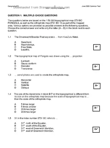
- Q1 Multiple-Choice QuestionsThe questions below are based on the 1:50 000 topographical map 2731BC 15 marks
- Q2 Mapwork Techniques and Calculations2.1.1 Calculate the area, in km², of the aerodrome marked 9 on the orthophoto 20 marks
- Q3 Application and Interpretation3.1 Refer to the Sipandlule River in block F 2 on the topographical map. 25 marks
- Q4 Geographical Information Systems (Gis)4.1 The COVID -19 pandemic resulted in a national lockdown. The National 15 marks
Geography Grade 12 Term 2 2019 question papers and memos
May/June 2019 Paper 1
225 marks · 3 hours · 15 pages · 4 questions
- Question Paper (English)
- Question Paper (Afrikaans)
- Memo (English)
- Memo (Afrikaans)
- Addendum (English)
- Addendum (Afrikaans)
What is in this paper (4 questions)
- Q1 1.1 Refer to FIGURE 1.1 showing a cross-section of a tropical cyclone. Choose 75 marks
- Q2 2.1 Refer to FIGURE 2.1 showing the distribution of temperature over an urban 75 marks
- Q3 3.1 Refer to FIGURE 3.1 showing rural settlement patterns. Match the 75 marks
- Q4 4.1 Match each of the descriptions below with either a high-order or a low-order 75 marks
Instructions to candidates
- This question paper consists of FOUR questions.
- Answer ANY THREE questions of 75 marks each.
- All diagrams are included in the ANNEXURE.
- Leave a line between the subsections of questions answered.
- Start EACH question at the top of a NEW page.
- Number the answers correctly according to the numbering system used in this question paper.
- Number the answers in the centre of the line.
- Do NOT write in the margins of the ANSWER BOOK.
- Draw fully labelled diagrams when instructed to do so.
- Answer in FULL SENTENCES, except when you have to state, name, identify or list.
- Write neatly and legibly. Geography/P1 3 DBE/2019 SC/NSC
May/June 2019 Paper 2
75 marks · 1 h 30 min · 13 pages · 4 questions
The memo for this paper is not available yet.
What is in this paper (4 questions)
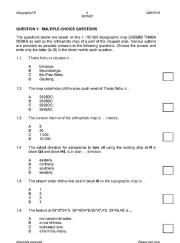
- Q1 Multiple-Choice QuestionsThe questions below are based on the 1 : 50 000 topographic map (2926BB THABA 15 marks
- Q2 Map Calculations and Techniques2.1 Refer to the orthophoto map. 20 marks
- Q3 Application and Interpretation3.1 Does the mapped area receive annual rainfall or seasonal rainfall? Give ONE 25 marks
- Q4 Geographical Information Systems (Gis)4.1 Refer to block C2 on the topographic map. 15 marks
Instructions to candidates
- Write your EXAMINATION NUMBER and CENTRE NUMBER in the spaces on the cover page.
- Answer ALL the questions in the spaces provided in this question paper.
- You are provided with a 1 : 50 000 topographic map 2926BB THABA NCHU and an orthophoto map 2926 BB 17 THABA NCHU (NORTH) of a part of the mapped area.
- You must hand the topographic map and the orthophoto map to the invigilator at the end of this examination session.
- You may use the blank page at the end of this question paper for all rough work and calculations. Do NOT detach this page from the question paper.
- Show ALL calculations and formulae, where applicable. Marks will be allocated for these.
- Indicate the unit of measurement in the final answer of calculations, e.g. 10 km; 2,1 cm.
- You may use a non-programmable calculator.
- You may use a magnifying glass.
- The area demarcated in RED on the topographic map represents the area covered by the orthophoto map.
- The following English terms and their Afrikaans translations are shown on the topographic map: ENGLISH AFRIKAANS Diggings Uitgrawings Furrow Voor Golf Course Gholfbaan Landing Strip Landingstrook Quarry Steengroef Rifle Range Skietbaan River Rivier Sewerage Wo
Geography Grade 12 Term 2 2018 question papers and memos
May/June 2018 Paper 1
225 marks · 3 hours · 14 pages · 4 questions
- Question Paper (English)
- Question Paper (Afrikaans)
- Memo (English)
- Memo (Afrikaans)
- Addendum (English)
- Addendum (Afrikaans)
What is in this paper (4 questions)
- Q1 1.1 Refer to FIGURE 1.1 showing stages in the development oa f mid-latitude 75 marks
- Q2 2.1 Refer to FIGURE 2.1 which indicate pressure cells and match EACH of the 75 marks
- Q3 3.1 Choose a term in COLUMN B that matches the description in COLUMN A. 75 marks
- Q4 4.1 Refer to FIGURE 4.1 on rural settlement. Ms atch EACH of the descriptions 75 marks
Instructions to candidates
- This question paper consists of FOUR questions.
- Answer ANY THREE questions of 75 marks each.
- All diagrams are included in the ANNEXURE.
- Leave a line between subsections of questions answered.
- Start EACH question at the top of a NEW page.
- Number the answers correctly according to the numbering sysemt used in this question paper.
- Number the answers in the centre of the line.
- Do NOT write in the margins of the ANSWER BOOK.
- Draw fully labelled diagrams when instructed to do so.
- Answer in FULL SENTENCES, except where you have to state, name ,identify or list.
- Units of measurement MUST be indicated in your final a nswers, e.g. 1 020 hPa, 14 °C and 45 m.
- Write neatly and legibly. Geography/P1 3 DBE/2018 SCE
May/June 2018 Paper 2
75 marks · 1 h 30 min · 14 pages · 4 questions
What is in this paper (4 questions)
- Q1 Multiple-Choice QuestionsThe questions below are based on t: 50 000 the 1op ographi cmap (3318BC 15 marks
- Q2 Map Calculations and Techniques2.1 Products from Malmesbury are transported along the Nnat7 ional road to 20 marks
- Q3 Application and Interpretation3.1 Malmesbury receives seasonal rainfall. 25 marks
- Q4 Geographical Information Systems (Gis)4.1 Refer to the orthophoto map. 15 marks
Instructions to candidates
- Write your EXAMINATION NUMBER and CENTRE NUMBER in the space s provided on the cover page.
- Answer ALL the questions in the spaces provided in this question paper.
- You are provided with a 1 : 50 000 topographical map (3318BC MALMESBURY) and an orthophoto map 3318 B( C 25 MALMESBURY) of a part of the mapped area.
- You must hand the topographic map and the orthophoto map to the invigilator at the end of this examination session.
- You may use the blank page at the e ndof this question paper for all rough work and calculations. Do NOT detach this page from the question paper.
- Show ALL calculatiosn and formulae, where applicable. Marks will be allocated for these.
- Indicate the correct unit of measurement in the final answer for all calculations. No marks will be awarded for answers with no/incorrect units of measurement.
- You may use a non-programmable calculator and a magnifying glass.
- The area demarcated in RED on the topographic map represents the area covered by the orthophoto map.
- The following English terms and their Afrikaans translations are shown on the topographic map: ENGLISH AFRIKAANS Canal Kanaal Furrow Voor Golf Course Gholfbaan Prison Tronk Refuse Dump Vullisstortingterrein River Rivier Sewerage Works Rioolwerke Geography/P2 3
No papers match.
Geography Grade 12 Term 2 study material
8 files for Term 2: task, question paper and memo.
Geography Grade 12 Term 2 2026
-
Geography Grade 12 Term 2 2026 Task (Gauteng)
TaskTerm 2Gauteng
-
Geography Grade 12 Term 2 2026 Task (Free State)
TaskTerm 2Free State
-
Geography Grade 12 Term 2 2026 Task
TaskTerm 2
-
Geography Grade 12 Term 2 2026 Task (Limpopo)
TaskTerm 2Limpopo
-
Geography Grade 12 Term 2 2026 Question Paper
Question PaperTerm 2
Geography Grade 12 Term 2 2023
-
Geography Grade 12 Term 2 June 2023 Memo (Afrikaans)
MemoJune examTerm 2Afrikaans
-
Geography Grade 12 Term 2 June 2023 Memo (English)
MemoJune examTerm 2English
Geography Grade 12 Term 2 2019
-
Geography Grade 12 Term 2 June 2019 Paper 2 Memo
MemoPaper 2June examTerm 2
More Geography Grade 12 papers
Questions about these papers
Which years of Geography Grade 12 Term 2 papers are on this page?
Papers from 2026, 2025, 2024, 2023, 2022, 2021, 2020, 2019, 2018. The newest year is at the top.
How many marks is the Geography Grade 12 Term 2 paper?
The paper is usually out of 150 marks and you get 3 hours to write it.
How many marks is the Geography Grade 12 Term 2 paper 1?
Paper 1 is usually out of 150 marks and you get 3 hours to write it.
How many marks is the Geography Grade 12 Term 2 paper 2?
Paper 2 is usually out of 150 marks and you get 3 hours to write it.
Are the memos included?
Yes. 25 of the 34 papers on this page have their marking memo next to the question paper.
Is there Geography Grade 12 Term 2 study material on this page?
Yes. 8 files for Term 2: task, question paper and memo.
Which topics come up most in Paper 2?
Application and interpretation, multiple-choice questions and geographical information systems (gis), based on 4 papers on this page.