Geography Grade 10 Term 4 November Past Papers and Memos
2012 to 202113 papers56 PDFsEnglish / Afrikaans
Advertisement
This page has every Geography Grade 10 Term 4 paper we have, from 2012 to 2021: 13 question papers and 11 memos in 56 PDFs. Files are in English and Afrikaans. The newest year is first. Each paper shows the first page of questions, its marks and time, and what the questions cover.
Q11.1 Various options are provided as possible answers to the following questions.60 marks
Q2Geomorphology2.1 Various options are provided as possible answers to the following questions.60 marks
Q33.1.1 Choose the correct word/phrase between brackets.30 marks
Instructions to candidates
This question paper consists of THREE questions.
Answer ALL the questions in this question paper. 3 Answer QUESTION 3 (MAPWORK) on the spaces provided in this question paper. Detach QUESTION 3 from the question paper and attach it to your ANSWER BOOK. 4 Use the following material: An extract from the topogra
All diagrams are included in the ADDENDUM.
Leave a line between subsections of questions answered.
Start EACH question on a NEW page.
Number the answers correctly according to the numbering system used in this question paper.
Number the answers in the centre of the line.
Do NOT write in the margins of the ANSWER BOOK.
Draw fully labelled diagrams when instructed to do so.
Answer in FULL SENTENCES, except where you have to state, name, identify or list.
Write neatly and legibly.
November 2020 Paper 1
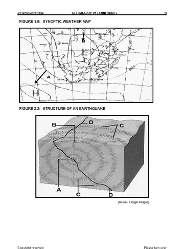
Geography Grade 10 November 2020 Paper 1 question paper
Q11.1 Various options are provided as possible answers to the following questions.60 marks
Q2Geomorphology2.1 Various options are provided as possible answers to the following questions.60 marks
Q33.1.1 Choose the correct word/phrase between brackets.30 marks
Instructions to candidates
This question paper consists of THREE questions.
Answer ALL the questions in this question paper. 3 Answer QUESTION 3 (MAPWORK) on the spaces provided in this question paper. Detach QUESTION 3 from the question paper and attach it to your ANSWER BOOK. 4 Use the following material: An extract from the topogra
All diagrams are included in the ADDENDUM.
Leave a line between subsections of questions answered.
Start EACH question on a NEW page.
Number the answers correctly according to the numbering system used in this question paper.
Number the answers in the centre of the line.
Do NOT write in the margins of the ANSWER BOOK.
Draw fully labelled diagrams when instructed to do so.
Answer in FULL SENTENCES, except where you have to state, name, identify or list.
Write neatly and legibly.
November 2020 Paper 2
Geography Grade 10 November 2020 Paper 2 question paper
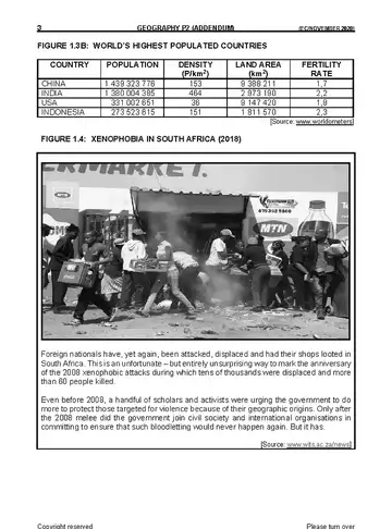
Q1Population1.1 Match the term/concept in COLUMN B with the correct description in COLUMN A.60 marks
Q2Water Resources2.1 Refer to FIGURE 2.1, showing the water cycle.60 marks
Q33.1.1 Refer to the information of the magnetic declination at the bottom of the30 marks
Instructions to candidates
This question paper consists of TWO sections. SECTION A is theory and SECTION B is mapwork.
Answer ALL questions in this question paper.
All diagrams are included in the ADDENDUM.
Leave a line between subsections of questions answered.
Start EACH question on a NEW page.
Number the answers correctly according to the numbering system used in this question paper.
Number the answers in the centre of the line.
Do NOT write in the margins of the ANSWER BOOK.
Draw fully labelled diagrams when instructed to do so.
Answer in FULL SENTENCES, except where you are asked to state, name, identify or list.
Please refer to the topographical map and orthophoto map to answer QUESTION 3 (Mapwork).
Show ALL calculations and formulas, where applicable. Marks will be awarded for this.
Indicate the unit of measurement in the final answer of the calculations. Make sure that the units in ALL your calculations and final answer are retained.
You may use a non-programmable calculator.
Geography Grade 10 Term 4 2019 question papers and memos
November 2019 Paper 1
Geography Grade 10 November 2019 Paper 1 question paper
Q1Multiple-Choice QuestionsThe questions below are based on the 1 : 50 000 topographic map 2730DD15 marks
Q22.1 Refer to the orthophoto map.20 marks
Q3Map and Photo Application and Interpretation3.1 Refer to block D4 on the topographic map.25 marks
Q4Geographic Information Systems (Gis)4.1 Refer to FIGURE 4.1 below which shows parts of a GIS component system15 marks
Instructions to candidates
Write your NAME in the space provided on the cover page.
Answer ALL the questions in the spaces provided in this question paper.
You are provided with a 1 : 50 000 topographic map (2730DD VRYHEID) and a 1 : 10 000 orthophoto map (2730DD 2 VRYHEID EAST) of a part of the mapped area.
You must hand in the topographic map and the orthophoto map to the invigilator at the end of this examination session.
You must use the blank page at the back of this paper for all rough work. DO NOT detach this page from the question paper.
Show ALL calculations and formulae, where applicable. Marks will be awarded for these.
Indicate the unit of measurement in the final answer of calculations. Ensure that units are maintained throughout ALL your calculations and final answer.
You may use a non-programmable calculator.
The area demarcated in BLACK on the topographic map represents the area covered by the orthophoto map.
A glossary of some of the Eish and Afrikaans words and their ngl translations appears below. ENGLISH AFRIKAANS Landing strip Vliegveld Furrow Voor Caravan Park Karavaanpark Canal Kanaal Sewerage works Rioolwerke Golf Course Gholfbaan Excavation Uitgrawing Natu
Advertisement
Geography Grade 10 Term 4 2018 question papers and memos
November 2018 Paper 1
Geography Grade 10 November 2018 Paper 1 question paper
Q1Multiple-Choice QuestionsThe questions below are based on the 1 : 50 000 topographic map 3126DD15 marks
Q22.1 Draw a line scale for this word scale:20 marks
Q3Map and Photo Application and Interpretation3.1 Provide TWO pieces of evidence from the map to prove that agriculture takes24 marks
Q4Geographic Information Systems (Gis)4.1 Define the term geographic information systems.16 marks
Instructions to candidates
Write your NAME in the space provided on the cover page.
Answer ALL the questions in the spaces provided in this question paper.
You are provided with a 1 : 50 000 topographic map (3126 BB QUEENSTOWN) and an orthophoto map (3126 DD 13 QUEENSTOWN) of a part of the mapped area.
You must hand in the topographic map and the orthophoto map to the invigilator at the end of this examination session.
You must use the blank page at the back of this paper for all rough work. DO NOT detach this page from the question paper.
Show ALL calculations and formulae, where applicable. Marks will be awarded for these.
Indicate the unit of measurement in the final answer of calculations. Ensure that units are maintained throughout ALL your calculations and final answer.
You may use a non-programmable calculator.
The area demarcated in RED on the topographic map represents the area covered by the orthophoto map.
A glossary of some of the English and Afrikaans words and their translations appears below. ENGLISH AFRIKAANS Landing strip Vliegveld Furrow Voor Caravan Park Karavaanpark Canal Kanaal Sewerage works Rioolwerke Golf Course Gholfbaan Excavation Uitgrawing Natur
Geography Grade 10 Term 4 2017 question papers and memos
November 2017 Paper 1
Geography Grade 10 November 2017 Paper 1 question paper
Q11.1 Refer to FIGURE 1.1 which shows the structure of the atmosphere and answer75 marks
Q22.1 Refer to FIGURE 2.1 showing different types of folding that can occur.75 marks
Q33.1 Match the population indicators in COLUMN B with the descriptions in COLUMN A.75 marks
Q44.1 Choose the correct word(s) between brackets to make the statement true. Write75 marks
Instructions to candidates
This question paper consists of FOUR questions.
Answer any THREE questions of 75 marks each.
All diagrams are included in the ANNEXURE.
Number the questions correctly according to the numbering system used in this question paper.
Leave a line between subsections of questions answered.
Start EACH question on a NEW page.
Do NOT write in the margins of the ANSWER BOOK.
Illustrate your answers with labelled diagrams, where possible.
Mark allocation is as follows: (2 x 1)(2) means that TWO facts are required for ONE mark each. (2 x 2)(4) means that TWO facts are required for TWO marks each.
If words/action verbs like name, identify, provide, classify, are used in a question, ONE-WORD answers are acceptable. If words/action verbs like discuss, define, explain, comment, evaluate, justify, suggest and substantiate are used in a question, FULL senten
Write neatly and legibly.
November 2017 Paper 2
Geography Grade 10 November 2017 Paper 2 question paper
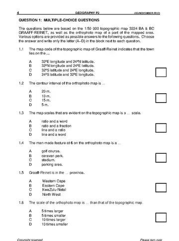
Q1Multiple-Choice QuestionsThe questions below are based on the 1:50 000 topographic map 3224 BA & BC15 marks
Q22.1 Interpret the map scale on the topographical map into a word scale.20 marks
Q3Map and Photo Application and Interpretation3.1 What is the altitude of the following features?25 marks
Q44.1 Write GIS in full.15 marks
Instructions to candidates
Write your NAME in the space provided on the cover page.
Answer ALL the questions in the spaces provided in this question paper.
You are provided with a 1 : 50 000 topographic map (3224 BA and BC GRAAFF-REINET) and an orthophoto map (3224 BC 1 GRAAFF-REINET) of a part of the mapped area.
You must hand in the topographic map and the orthophoto map to the invigilator at the end of this examination session.
You must use the blank page at the back of this paper for all rough work. DO NOT detach this page from the question paper.
Show ALL calculations and formulae, where applicable. Marks will be awarded for these.
Indicate the unit of measurement in the final answer of calculations. Ensure that units are maintained throughout ALL your calculations and final answer.
You may use a non-programmable calculator.
The area demarcated in RED on the topographic map represents the area covered by the orthophoto map.
A glossary of some of the English and Afrikaans words and their translations appears below. ENGLISH AFRIKAANS Landing strip Vliegveld Furrow Voor Caravan Park Karavaanpark Canal Kanaal Sewerage works Rioolwerke Golf Course Gholfbaan Excavation Uitgrawing Natur
Geography Grade 10 Term 4 2012 question papers and memos
Exemplar 2012 Paper 1
Geography Grade 10 Exemplar 2012 Paper 1 question paper
Q11.1 Study SOURCE 1.1 on the heang ofti the atmosphere anansd wer the75 marks
Q22.1 Give ONE word/term for each of tfolhloe w descriptions by choosing a75 marks
Q33.1 Give ONE word/term for each of the following descriptions by choosing a75 marks
Q4Study the two population pyram inids SOURCE 4.1. They represent two75 marks
Instructions to candidates
This question paper consists of FOUR questions.
Answer ANY THREE questions of 75 marks each.
ALL diagrams are included in the ANNEXURE.
Leave a line between subsections of questions.
Start EACH question at the top of a NEW page.
Number the answers correctly according to the numbering system used in this question paper.
Do NOT write in the margins of the ANSWER BOOK.
Where possible, illustrate your answers with labelled diagrams.
For the paragraph-style question you may refer to ONE idea which you must discuss in depth OR you may refer to different ideas which you mus tdiscuss in less depth.
Q1Multiple-Choice QuestionsThe questions below are based o 00n t0 the 1opographi:50cal map15 marks
Q2Map Calculations2.1 Calculate the straight-line distance along the N2 between benchmark 20 920 marks
Q3Application and Interpretation3.1 You are a first-time hiker who is not very fit. You can choose to hike from25 marks
Q4Geographic Information Sytems4.1 Write the acronym GIS in full.15 marks
Instructions to candidates
Write your name in the space provided on the cover page.
Answer ALL the questions in the spaces provided in this question paper.
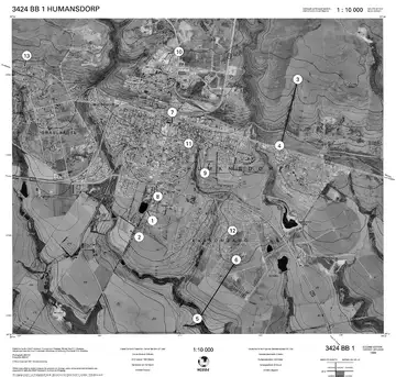
You are supplied with a 1:50 000 topographical map 3424BB HUMANSDORP and an orthophoto map of a part of the mapped area.
You must hand the topographical map and the orthophoto map to the invigilator at the end of this examination session.
You must use the blank page at the back of this paper for all rough work and calculations. Do NOT detach this page from the question paper.
Show ALL calculation sand the formulae where applicabl. Me arks will be allocated for this.
You may use a non-programmable calculator.
The following English terms or their Afrikaans translations are shown on the topographical map. ENGLISH AFRIKAANS Diggings Uitgrawings Caravan Park Karavaanpark Sewage Works Rioolwerke River Mouth Riviermond Golf Course Gholfbaan Wetland Vlei Geography/P2 3 DB